Jerusalem - The Movie

Jerusalem - The Movie

jerusalem_the_movie.jpg

Earlier today, the folks putting together the new movie about Jerusalem released their official trailer for the movie. It is fantastic. I invite you to watch it.

Honestly, I do not know the agenda behind the people putting this together, so I really can't speak to the message it will provide. However, the wonderful pictures are breathtaking. Jerusalem is a beautiful city. And, it is in a the middle of a beautiful country.

I am hopeful that this movie comes to an IMAX theatre in my area of the country. I can't wait to see these images on a huge screen. But, seeing this movie will not be as good as being there in person.

I'm going next June. Want to join me?

The Good Shepherd

The Good Shepherd

IMG_1869.jpg

A shepherd watches over his flock near Nazareth.Everytime I see this photograph, I think of the words of Jesus from John 10:

“Most assuredly, I say to you, he who does not enter the sheepfold by the door, but climbs up some other way, the same is a thief and a robber. But he who enters by the door is the shepherd of the sheep. To him the doorkeeper opens, and the sheep hear his voice; and he calls his own sheep by name and leads them out. And when he brings out his own sheep, he goes before them; and the sheep follow him, for they know his voice. Yet they will by no means follow a stranger, but will flee from him, for they do not know the voice of strangers.” Jesus used this illustration, but they did not understand the things which He spoke to them. Then Jesus said to them again, “Most assuredly, I say to you, I am the door of the sheep. All who ever came before Me are thieves and robbers, but the sheep did not hear them. I am the door. If anyone enters by Me, he will be saved, and will go in and out and find pasture. The thief does not come except to steal, and to kill, and to destroy. I have come that they may have life, and that they may have it more abundantly. “I am the good shepherd. The good shepherd gives His life for the sheep. But a hireling, he who is not the shepherd, one who does not own the sheep, sees the wolf coming and leaves the sheep and flees; and the wolf catches the sheep and scatters them. The hireling flees because he is a hireling and does not care about the sheep. I am the good shepherd; and I know My sheep, and am known by My own. As the Father knows Me, even so I know the Father; and I lay down My life for the sheep. And other sheep I have which are not of this fold; them also I must bring, and they will hear My voice; and there will be one flock and one shepherd.

Ironically, I took this picture near the town of Nazareth, the same city where Jesus spent most of his childhood. It seems appropriate.

The View from King Ahab's Front Porch

The View from King Ahab's Front Porch

file_zpsa27f80dd.jpg

The above picture was taken from the tel at Jezreel, looking north toward the Hill of Moreh across the Jezreel Valley. How many Biblical events can you name that took place within the area of this picture? Here is a partial list:

  • King Ahab, and his wife Jezebel, built a palace in Jezreel. This view is what they would have seen when they looked across the valley.
  • Gideon defeated the mighty Midianite army with only 300 men by surrounding their camp which was located at the base of the Hill of Moreh.
  • The prophet Elisha often stayed with a couple from Shunam. Shunam was a small city on the western edge of the Hill of Moreh.
  • King Saul once visited a medium who lived at En-Dor. That small town was located on the other side of the Hill of Moreh.
  • Jesus raised a widow's son at Nain, which was located on the other side of the Hill of Moreh.

And, here is one more item of interest...

  • In 1 Samuel 29:1, we are told that in preparation to battle the Philistines, the Israelites encamped at the spring of Jezreel. Do you see the group of trees to the right in the picture? That's the location of the spring.

There is so much history in such a small area. Isn't that interesting?

The Pinnacle of the Temple

The Pinnacle of the Temple

file_zpsf0889f46.jpg

In Matthew 4, we read the account of Satan tempting Jesus. One of those temptations is recorded in verses 5-7.

Then the devil took Him up into the holy city, set Him on the pinnacle of the temple, and said to Him, “If You are the Son of God, throw Yourself down. For it is written: ‘He shall give His angels charge over you,’ and, ‘In their hands they shall bear you up, lest you dash your foot against a stone.’” Jesus said to him, “It is written again, ‘You shall not tempt the Lord your God.’”

So, where is the "pinnacle of the temple"? Is it the top of the building? Honestly, we do not know. However, there are a couple of places that are generally considered when trying to answer this question.

The most accepted location is the southeastern corner of the Temple Mount. This would have been where the Royal Portico and Solomon's Porch met overlooking the Kidron Valley. At the time of Jesus, the height from this location into the Kidron Valley would have been around 450 feet. Of course, the top of the walls have been destroyed and rebuilt since then, so it is hard to know exactly how high it would have been. Either way, it would have been a very long fall into the Kidron Valley. The image at the top of this post is a picture that I took last September from the area of the Gihon Spring.

The southwest corner of the Temple Mount.The other location that is often discussed as being a possible location of the pinnacle of the temple is the southwestern corner of the Temple Mount. From this corner, you would have overlooked the Upper and Lower City and you would be directly above a Roman street complete with shops and other places of business. Back in the late 1960's, excavations directly below this spot revealed temple stones which were cast over during the destruction of Jerusalem in 70AD as well as an inscription. This inscription, which also fell from above, describes the southwest corner as "the place of the trumpeting". From this location, a priest would have blew his trumpet for different Jewish events. The image to the left is a current picture of this corner with with the buttress of Robinson's Arch about halfway down.

The southeast and southwest corners of the Temple Mount from the Jerusalem Model at the Israel Museum.The final picture was taken at the model of Jerusalem at the Israel Museum. This model, around an acre in size, depicts Jerusalem during the first century. In this picture, you can see both of the Temple Mount corners that we have discussed here.

Both locations are viable options for the location of the pinnacle of the temple. From either location, a person would face certain death if they decided to jump off. Luckily for us, Jesus used His wisdom and did not succumb to any of the temptations that were thrown at him by the Devil. We all have a lot to learn from His example.

Parable of the Ten Virgins

Earlier today, I read a fantastic blog post by Steven Braman about the Parable of the Ten Virgins. He uses the analogy of his experience with the Boy Scouts and their motto which states "Be Prepared". If you are unfamiliar with the parable, then I invite you to read Matthew 25:1-13. He illustrates the parable by showing pictures of an Iron Age juglet and and Roman-era oil lamp, both of which play prominently into the story. Last September, Steven and I were traveling through Israel with our friends Trent and Rebekah while on one of Ferrell Jenkins' tours. Trent and Rebekah purchased the two items that are pictured while we were in Samaria. They currently use them for teaching purposes and graciously allowed me to take pictures of them a few months ago.

Understanding the people, places and things associated with the Bible help you to better understand the stories. Thank you Steve, Trent and Rebekah, for helping us understand this parable better.

Back In The Saddle

Sunrise over the Sea of Galilee.  Photo by Trent and Rebekah Dutton.For those of you who are frequent readers of this blog, you probably have noticed that I have not written much lately. That is due to the fact that my wife and I recently spent a week and a half in London, Paris and Edinburgh celebrating our 20th wedding anniversary. I have a number of posts that I want to write, mostly of items that we viewed in the British Museum. For now, I want to share a post that was written this morning from my friends Trent and Rebekah. They are currently touring the country of Israel and spent some time around the Sea of Galilee. This morning, they posted a beautiful picture of the sun rising over the Golan Heights on the eastern side of the sea.

If you ever go on a trip to Israel, you will visit all of the very popular sites (Caesarea, Megiddo, Jerusalem, etc). But, there are also hidden gems that it is up to you to find to make your visit extra special. One of those gems is to get up early and watch the sun rise over the Sea of Galilee. Due to the geographic nature of that entire area, clouds can form and dissipate very quickly, often producing amazing sun rises.

Seeing this, it is easy to imagine Peter, Andrew, James and John seeing similar sun rises as they prepared their nets for their daily work.

The Mount of Olives

The Mount of Olives

file_zps5d96c665-001.jpg

For anyone who visits the land of Israel, a "must do" is a stop at the top of the Mount of Olives. The view of Jerusalem from this famous peak is one that you will never forget. Not only is it a beautiful view, but you can also visualize a number of Biblical stories from that spot. How many Biblical stories can you name that happened on or around the Mount of Olives? I've updated the Jerusalem page on the website with a link to information about the Mount of Olives. Give it a minute and see how many you can think of. Then, compare your list with mine.

More Information on the Ophel Excavations

The black screens cover the areas of the Ophel Excavations on the south end of the Temple Mount in Jerusalem.For the past several summers, Dr. Eilat Mazar has been leading many of the excavations around the City of David just south of the Temple Mount in Jerusalem. Recently, she has been concentrating her efforts in the area of the Ophel. A couple of days ago, their group released a fantastic video showing some of the most recent excavations. These digs have centered around a cistern from the Second Temple period as well as some underground caverns and tunnels. The current assumptions is that the cistern collected rain water for public use during the time of King Herod.

The Jewish historian, Josephus, mentions that many of the Jews hid in underground caverns and tunnels during the time of the Roman overthrow of Jerusalem around 70AD. It is possible that some of these tunnels that are mentioned in the video are the same ones mentioned by Josephus.

Honestly, it may be hard to know exactly. But, it is interesting to think about.

I wonder what they will dig up next?

Possible Site of Tabernacle at Shiloh

This picture of Tel-Shiloh in the Hill Country.  Photo taken by Ferrell Jenkins.Earlier this year, I had a series of posts about the different locations in which the Ark of the Covenant resided during the period of the Conquest of Canaan, Judges and Kings. (The final article, with links to the other articles, was a post about the city of Jerusalem.) One of those articles had to do with the period of time that the Ark spent in Shiloh. Well, earlier today, Israel Hayom reported that archaeologists have possibly found the post holes for the tabernacle at Shiloh. (Both Ferrell Jenkins and Todd Bolen mentioned this in their blogs this morning.) Later this week, an announcement will be made which will contain information about the find and give us more insight into what they think they have found.

Stay tuned.

HT: Todd Bolen, Ferrell Jenkins

He Walked To Jerusalem

Jericho and Jerusalem from the Dead Sea Spa Hotel in Jordan.Frequent readers of this blog may already recognize the picture above. I have used it a couple of times. It is a picture taken from the Dead Sea Spa Hotel on the eastern shore of the Dead Sea. We are looking across the Dead Sea at the cities of Jericho (lower) and the outskirts of Jerusalem (on top of the hill). I like this picture because it helps us to understand passages better. For instance, consider this verse:

When He had said this, He went on ahead, going up to Jerusalem. - Luke 19:28

This verse follows the account of Jesus' interaction with Zacchaeus in Jericho. It is only 13 words long and simply says that he went "up to Jerusalem". Although the passage doesn't mention how he went up, we can probably safely assume that he walked. He walked to Jerusalem.

The elevation of Jerusalem is around 2500 feet ABOVE sea level. The elevation of Jericho is around 800 feet BELOW sea level. The distance between the two cities is about 12-14 miles (depending on the exact path that you took). This picture was taken in late April, which is a little after the time of year of which this passage is written. The latter rainy season has ended, so there is nothing but clear skies.

14 miles. Uphill. In the direct sunlight. He walked. And, of course, He knew that He was walking to his death.

Knowing the land of the Bible helps you understand the Bible.

Perhaps in later posts, I'll talk about more paths that were walked in the Bible.

Abel Beth Maacah

Abel Beth Maacah from the northwest.  Picture by Todd Bolen.To begin, let me encourage everyone to sign up for Todd Bolen's Bible Places blog. (I mention him, as well as others on the "Resources" page of my website.) Every week, he and his writers supply great information about many of the places in the Bible. One of the writers is a gentleman by the name of Seth Rodriquez. Every week, he posts a "Picture of the Week". This week's picture is an aerial picture of Abel Beth Maacah. I will let you read his blog to learn all of the locations in the Bible where this city is mentioned. I have never been in a plane and seen this tel from the angle of this picture, but I have driven around it a couple of times. I enjoy seeing this particular location. It is often overlooked by tour groups. Groups often drive through the upper Hula Valley on Highway 90 to Kiryat Shmona, but then turn east on Highway 99 to get to sites such as Tel Dan and Banias. But, if you travel just a little farther north on Highway 90, you can see this beautiful location.

Here are some links to some other posts of mine about Abel Beth Maacah Abel Beth Maacah Excavations at Abel Beth Maacah 2012 Israel Trip - Day Four

This year's excavations are about to start at the site. So, I'm looking forward to seeing what they find.

Wheat in Israel

WheatSometimes, I read a story in the Bible and it causes me to laugh. Recently, I was in a study of the Judges, and I was reminded of one of the accounts of Samson.

After a while, in the time of wheat harvest, it happened that Samson visited his wife with a young goat. And he said, “Let me go in to my wife, into her room.” But her father would not permit him to go in. Her father said, “I really thought that you thoroughly hated her; therefore I gave her to your companion. Is not her younger sister better than she? Please, take her instead.” And Samson said to them, “This time I shall be blameless regarding the Philistines if I harm them!” Then Samson went and caught three hundred foxes; and he took torches, turned the foxes tail to tail, and put a torch between each pair of tails. When he had set the torches on fire, he let the foxes go into the standing grain of the Philistines, and burned up both the shocks and the standing grain, as well as the vineyards and olive groves. - Judges 15:1-5

This story just made me laugh. If there is a universal truth it is this: When it comes to girls, guys act crazy some times.

But, as you can read from the story, this takes place during the time of the wheat harvest. In Israel, the wheat is usually harvested in late May or June. In 2010, I saw a beautiful field of wheat in the Valley of Harod that was only a couple of weeks from being harvested. These fields are very common in a number of areas around Israel, but in particular in and around the Jezreel Valley and in the Shephelah.

We also read of wheat in the story of Ruth:

And Naomi said to Ruth her daughter-in-law, “It is good, my daughter, that you go out with his young women, and that people do not meet you in any other field.” So she stayed close by the young women of Boaz, to glean until the end of barley harvest and wheat harvest; and she dwelt with her mother-in-law. - Ruth 2:22-23

The Sower

A sower sowing his seed near Nazareth. Then He spoke many things to them in parables, saying: “Behold, a sower went out to sow. And as he sowed, some seed fell by the wayside; and the birds came and devoured them. Some fell on stony places, where they did not have much earth; and they immediately sprang up because they had no depth of earth. But when the sun was up they were scorched, and because they had no root they withered away. And some fell among thorns, and the thorns sprang up and choked them. But others fell on good ground and yielded a crop: some a hundredfold, some sixty, some thirty. He who has ears to hear, let him hear!” - Matthew 13:3-9

For all of you who said such kind things to my family over the last few days, thank you.

The Cilician Gates

The rugged Taurus Mountains.  Bible students contemplate lines on maps that indicate the route scholars believe Paul took on his second journey. These lines on Bible maps are not simply a “best guess” at the route of Paul. There is evidence to support the geographical markings, and this evidence is obvious if the Bible student has some familiarity with the geography and the recent discoveries in the area. The Cilician Gates with a modern highway going through them.For instance, the Bible tells us that Paul left from Antioch and “went through Syria and Cilicia…” (Acts 15:41) That tells us the general area Paul passed through, but to understand his route, we must study the landscape. The Taurus Mountains lie between Antioch and Cilicia, and many of those peaks are rocky and rise above 10,000 feet, making the area extremely difficult to cross. However, on closer inspection, you will notice that there is a gap in the mountains. This gap is referred to as the “Cilician Gates”. It allows for much easier passage though the area than any other place in close proximity. The Cilician Gates are only about 30 miles south of Tarsus, which was one of the great crossroad cities of the time. The apostle Paul referred to Tarsus as “…no mean (insignificant) city…” (Acts 21:39), partially due to the fact that it was located so close to this route through the Taurus Mountains.

Even today the major highway of the area follows a route in the only gap in the Taurus Mountains in the area…the Cilician Gates. This is the way people crossed this territory between Antioch and Tarsus in Bible times, and the way it is crossed today.

Khirbet Qeiyafa

High on the hill, Khirbet Qeiyafa overlooks with Elah Valley.This morning, a new short film has debuted on the Internet. It is called "Khirbet Qeiyafa" and discusses the recent archaeology surrounding a site on the northern side of the Elah Valley in Israel. The film debuted on Luke Chandler's blog site and it is one that I encourage you to watch. The interesting thing about archaeology is that we are continually learning about past civilizations. And, as more and more dirt is moved away, the more that we learn.

In Israel, this is a beautiful site. While there, you can open up your Bible, read the story of David and Goliath from 1 Samuel 17, and the whole story comes to life.

If you are interested in traveling with Luke Chandler, he is planning a trip to Italy this fall. I'm sure that he would enjoy having you join him.

More Maps of the Bible Lands

Google-logo
I love good maps. I think that I might have mentioned that before. When I'm not reading my Zondervan Pictorial Bible Dictionary or Satellite Bible Atlas, I usually looking at Google Maps.

Well, Google Maps has decided to enhance their product just a little bit. About a week ago, I read a tweet from Google concerning their new version of the popular mapping program. Since it is still in beta, you had to sign up and wait for an invitation before getting in. Last night, I received my invitation. It walked me through a tutorial of some of the features. It was interesting, but I wasn't really interested in finding the best sushi restaurant in San Francisco.

I set my sight on the Bible Lands. And, I was not disappointed. While Google does not have the same quality of imagery of Israel and the West Bank as they do of the United States, I was still impressed. They also have a feature that will allow you to see the terrain the three dimensions. Which, in my opinion, makes this a valuable tool for your Bible classes or in your personal study.

Let me give you a few examples. (You can click on the images to see a larger version of the pictures.)

First, here is a view looking east across the Sea of Galilee. In the foreground you can see the Plain of Gennesaret, Mount Arbel and the city of Tiberias. On the eastern side of the sea, the terrain rises sharply as you go into the Golan Heights.

Google Maps image looking east over the Sea of Galilee.

In the second picture, we are again looking across the Sea of Galilee, but toward the north. You can see the city of Tiberias to your left, the Plain of Gennesaret and the northern shore where the city of Capernaum is located. You can follow the Jordan Rift Valley north from the Sea until you reach Mount Hermon far in the distance.

Google Earth image looking north across the Sea of Galilee.

Next, we have an picture of the western side of the Dead Sea. In the foreground, you can see Herod's fortress of Masada. For everyone that has been to Masada, you have probably stood on the northern end of the plateau and taken almost this exact same picture. (And, for those of you who have a mental image of the Dead Sea that appears to be "dead", think again. The water in the Dead Sea is really that color of blue.)

Google Earth image looking north along the western shore of the Dead Sea.

Finally, we have a picture looking east down the Valley of Elah. This valley is mostly known as the location where David slew the Philistine giant, Goliath. In the story, the Israelites were on the ridge on the left side of the picture, and the Philistines occupied the ridge to the right. Running through the middle of the valley is a stream, which is where the young David picked up his ammunition for his battle. The two warriors met in that valley.

Google Earth image looking east down the Valley of Elah.

I'm looking forward to finding other sites and seeing how they are depicted. While this is no replacement for seeing actual photographs or especially visiting these sites for yourself, it is a wonderful resource that should be used by every Bible student.

Random Items of Interest

Tel Burna, located in the Shephelah, is one of the possible locations of Biblical Libnah.Over the past couple of days, a number of little things have come across my desk that I wanted to write about. However, they are starting to pile up, so here is a quick list of items that I thought that you might enjoy. Khirbet Qeiyafa Video - Luke Chandler announced on his blog yesterday that there is a 20 minute video that will be released soon about Khirbet Qeiyafa (sometimes called "The Elah Fortress"). Luke has participated in the dig at that site for a number of years. The video will be released on his blog on June 1. T-minus 10 days and counting....

The Jesus Trail - The BBC has written an interesting piece on the Jesus Trail. It is a 65KM trail that stretches between Nazareth to Capernaum. I have spoken to a couple of people who have hiked this trail. It is on my bucket list. What a fantastic way to learn more about these Biblical lands.

Satellite Bible Atlas - A couple of months ago, I wrote a post about the Satellite Bible Atlas by Bill Schlegel who works at IBEX. Ferrell Jenkins, who recently completed a tour of Israel, provided his tour group with this amazing book. Likewise, I highly recommend that everyone adds this book to your library.

Dig Time - With the summer season approaching, it is time to think about the archaeological digs that will be taking place in the next couple of months. Tel Burna (possibly the site of Biblical Libnah) will be starting their summer dig on June 1. I have some friends that are about to start working with the dig at Ashkelon, one of the Philistine cities during the United and Divided Kingdom periods. Abel Beth Maacah will begin their second season of digging soon. And, of course, there are a number of other digs that are ongoing or will be starting up in the next few weeks. Stay tuned for updates.

Water Flowing From The Sea of Galilee

The Senir River in northern Israel.  The Senir River drains the snow melt from Mount Hermon into the Jordan River north of the Sea of Galilee.I was thrilled yesterday to read a story in the Jerusalem Post concerning an increase in the amount of water that they are allowing to flow into the Jordan River. In the past, I have written a number of posts about the water levels in the Sea of Galilee, Jordan River and the Dead Sea. To recap, you can read them here:

However, over the winter, the country of Israel has received a large amount of rain. Mount Hermon, located in the northern part of the country, had a large amount of snow. That snow is now melting and is draining into the Sea of Galilee. About a month ago, Ferrell Jenkins supplied two pictures of the difference in the Sea between last September and April.

Slow water flow of the Jordan River at Qasr al-Yahud.  The Jerusalem Post article mentions that beginning next month, they will release an additional 1,000 cubic meters of water per hour into the Jordan River. I'll be anxious to see what difference this makes further downstream. Currently, by the time the Jordan River flows at Qasr al-Yahud (the traditional Jesus baptismal site in Israel), it is hardly flowing at all. You can see this by looking at the picture to the right.

HT: Todd Bolen

Muhraqa

The Jezreel Valley from the top of Mount Carmel.In our Bible class at church, we have been studying the period of time that we commonly refer to as The Divided Kingdom. It is the time in which the people of Israel had divided itself into two, separate nations. Last week, our study focused on the prophet Elijah and the work that he did in the Northern Kingdom of Israel. 
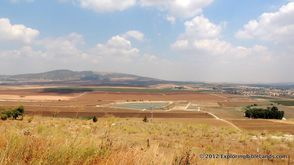
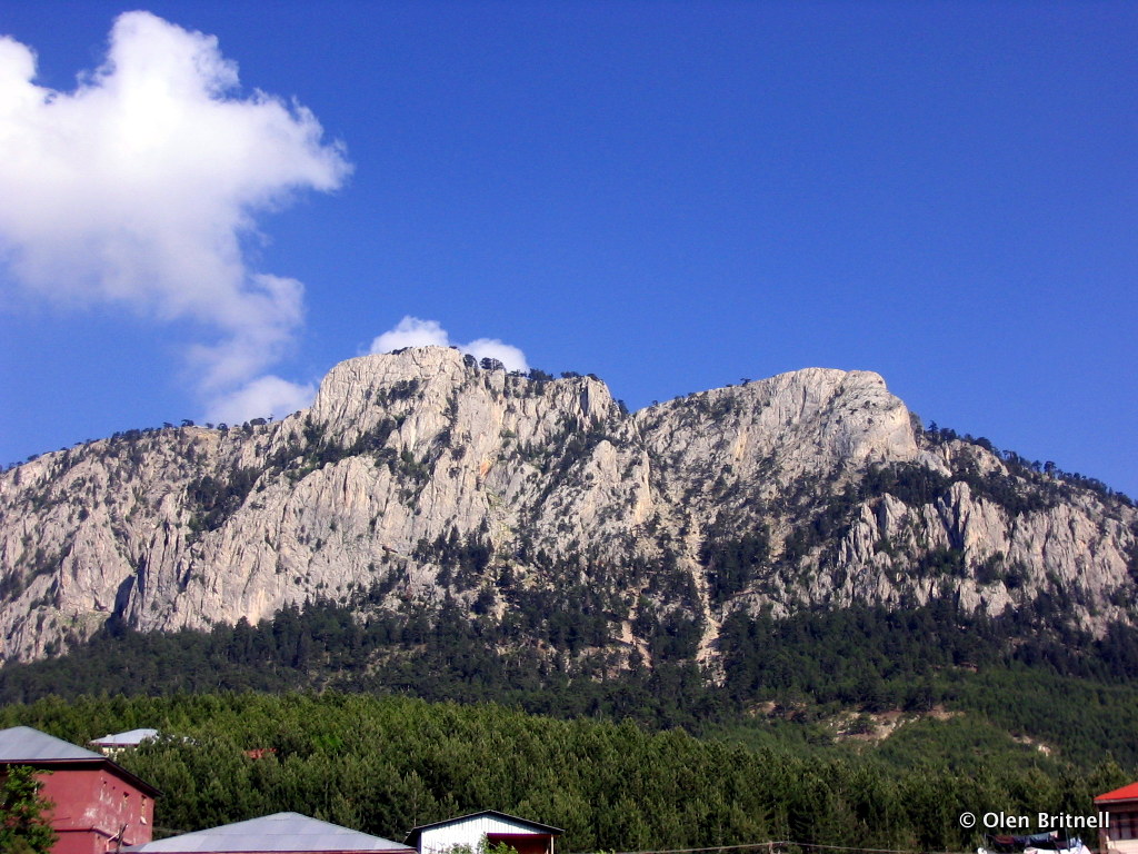
One of the most memorable stories is of Elijah's contest against the prophets of Baal on Mount Carmel. Mount Carmel is actually a range of mountains that run from the northwest to the southeast and compromise the southwestern edge of the Jezreel Valley. The traditional location of this event is at Muhraqa, which is located about 500 meters (about 1600 feet) above the valley floor.

I don't hike as much as I used to. But, when I do, I really enjoy it. However, if there is one thing that I have learned in hiking, it is to never underestimate the height of the mountain you are climbing. In this case, 500 meters may not sound like a lot of elevation to climb, but it can be. Especially if you have to do it twice!

In 1 Kings 18, it mentions that Elijah and all of the people gathered on top of Mount Carmel.

So Ahab sent for all the children of Israel, and gathered the prophets together on Mount Carmel. - 1 Kings 18:20.

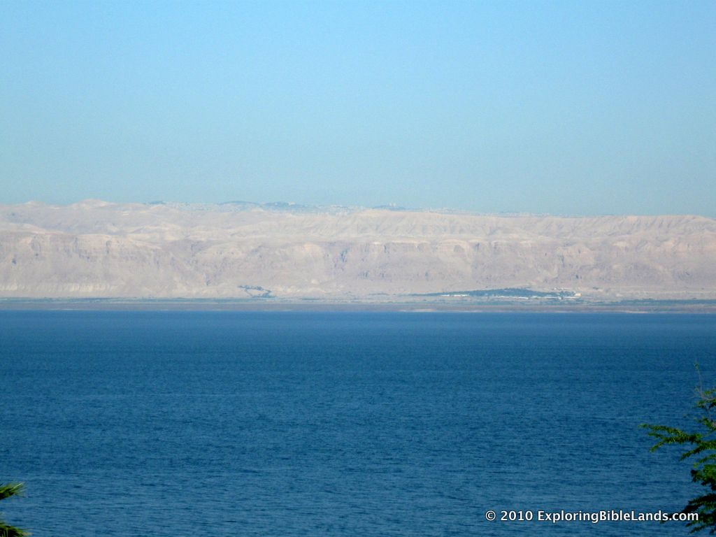
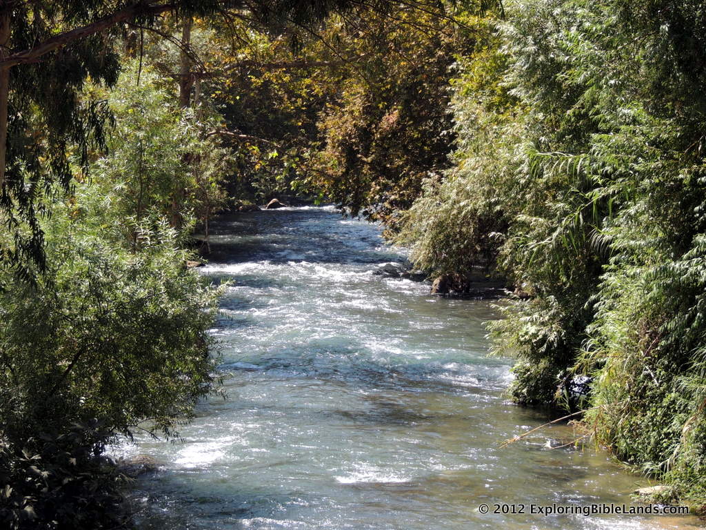
Then, after God showed his power to the people, Elijah gathered the 450 prophets of Baal and slew them at the Kishon Brook. The Kishon Brook is located in the floor of the Jezreel Valley.

And Elijah said to them, “Seize the prophets of Baal! Do not let one of them escape!” So they seized them; and Elijah brought them down to the Brook Kishon and executed them there. - 1 Kings 18:40

A close up of the Kishon Brook from the top of Mount Carmel.
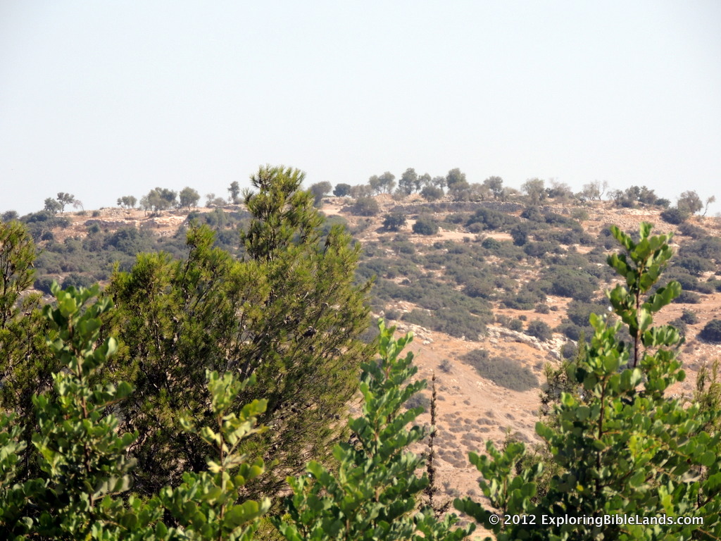
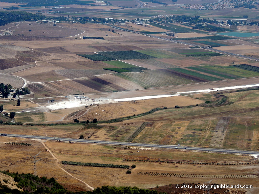
(The picture at the top of the this post shows the view from Mount Carmel looking east. The Kishon Brook is in the foreground on the valley floor. The second picture shows you a closeup of the brook, located along the line of shrubs just above the modern road.)

Then, after Elijah warns Ahab about the rain and then reclimbs Mount Carmel.

Then Elijah said to Ahab, “Go up, eat and drink; for there is the sound of abundance of rain.” So Ahab went up to eat and drink. And Elijah went up to the top of Carmel; then he bowed down on the ground, and put his face between his knees, and said to his servant, “Go up now, look toward the sea.” - 1 Kings 18:41-43a

After Elijah sees that his prediction of rain was about to come true, he heads towards the city of Jezreel, which is about 25 kilometers (16 miles) away.

Honestly, the exact timeframe of all of these events is uncertain. But regardless, this is a lot of ground for one man to cover in a short amount of time. Up a mountain, down a mountain, up a mountain and then 16 miles to Jezreel. I am tired just reading it.

Jezreel

Jezreel (center) and the surrounding area.  Picture from the Jezreel Expedition Facebook Page, taken by Todd Bolen Earlier today, the Jezreel Expedition Facebook page updated their cover photo. All I have to say is "wow". That is a fantastic aerial shot of Jezreel as it overlooks the southeastern corner of the Jezreel Valley and the Valley of Harod.

This picture is facing almost due east. Jezreel is the light brown area just below the exact center of the picture. The northern end of Mount Gilboa is off to the right and the Transjordan Plateau is in the distance. The Jordan River, which sits in the Jordan Rift Valley is not visible as it falls below the land line between Jezreel and the Transjordan Plateau.

How many Biblical events can you name that happened in this picture? Well, here is a list to get you started.

  • Gideon narrowed his army from many thousand to only 300 men at the Spring of Harod. That spring is located at the foot of Mount Gilboa in the closest shady area just beyond Jezreel. Later that night, Gideon attacked the Midianites near the Hill of Moreh, located just off of the picture to the left. (Judges 7:1-25)
  • Saul was killed on Mount Gilboa. When the Philistines found Saul's body, they took it and hung it over the walls at Beth-Shean. Beth-Shean sits about halfway between Mount Gilboa and the Jordan River (not visible from this angle). (1 Samuel 31:1-10)
  • Jehu rode "furiously" through this area. Jehu had been anointed by a prophet to be the next king of Israel at Ramoth Gilead. Ramoth Gilead was located on top of the Transjordan Plateau in the distance in this picture. A Jehu was riding back to Jezreel, the men in the tower saw him coming up the valley you see in the picture. (2 Kings 9:1-29)
  • This view is probably the last view that Jezebel saw just before she was pushed out a window to her death. (2 Kings 9:30-37)

Many other Biblical events happened within the view of this picture. In addition, anyone traveling from the Galilee area (to the upper left) to the Jerusalem area could have come through this area.

To the Jezreel Expedition: Thanks for supplying this picture! And to Todd Bolen, thanks for taking the picture! It was a great reminder of all of the things that happened here.