
![]()
I love good maps. I think that I might have mentioned that before. When I'm not reading my Zondervan Pictorial Bible Dictionary or Satellite Bible Atlas, I usually looking at Google Maps.
Well, Google Maps has decided to enhance their product just a little bit. About a week ago, I read a tweet from Google concerning their new version of the popular mapping program. Since it is still in beta, you had to sign up and wait for an invitation before getting in. Last night, I received my invitation. It walked me through a tutorial of some of the features. It was interesting, but I wasn't really interested in finding the best sushi restaurant in San Francisco.
I set my sight on the Bible Lands. And, I was not disappointed. While Google does not have the same quality of imagery of Israel and the West Bank as they do of the United States, I was still impressed. They also have a feature that will allow you to see the terrain the three dimensions. Which, in my opinion, makes this a valuable tool for your Bible classes or in your personal study.
Let me give you a few examples. (You can click on the images to see a larger version of the pictures.)
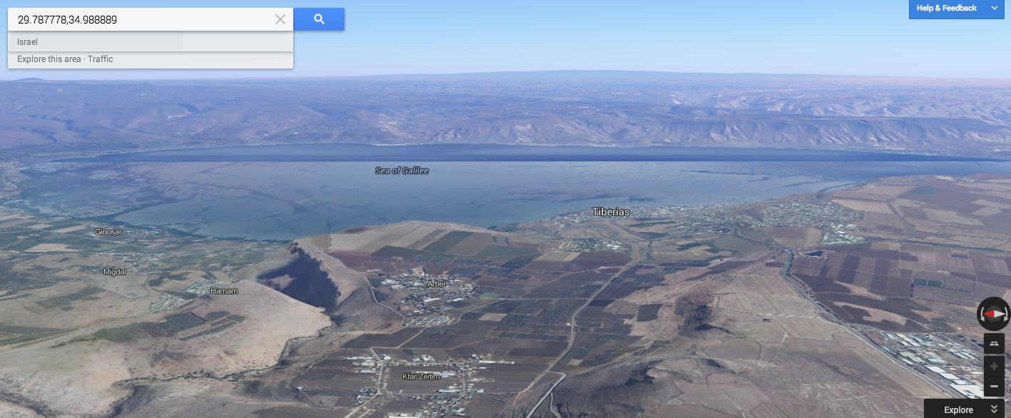
First, here is a view looking east across the Sea of Galilee. In the foreground you can see the Plain of Gennesaret, Mount Arbel and the city of Tiberias. On the eastern side of the sea, the terrain rises sharply as you go into the Golan Heights.
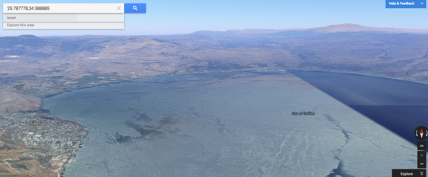
In the second picture, we are again looking across the Sea of Galilee, but toward the north. You can see the city of Tiberias to your left, the Plain of Gennesaret and the northern shore where the city of Capernaum is located. You can follow the Jordan Rift Valley north from the Sea until you reach Mount Hermon far in the distance.
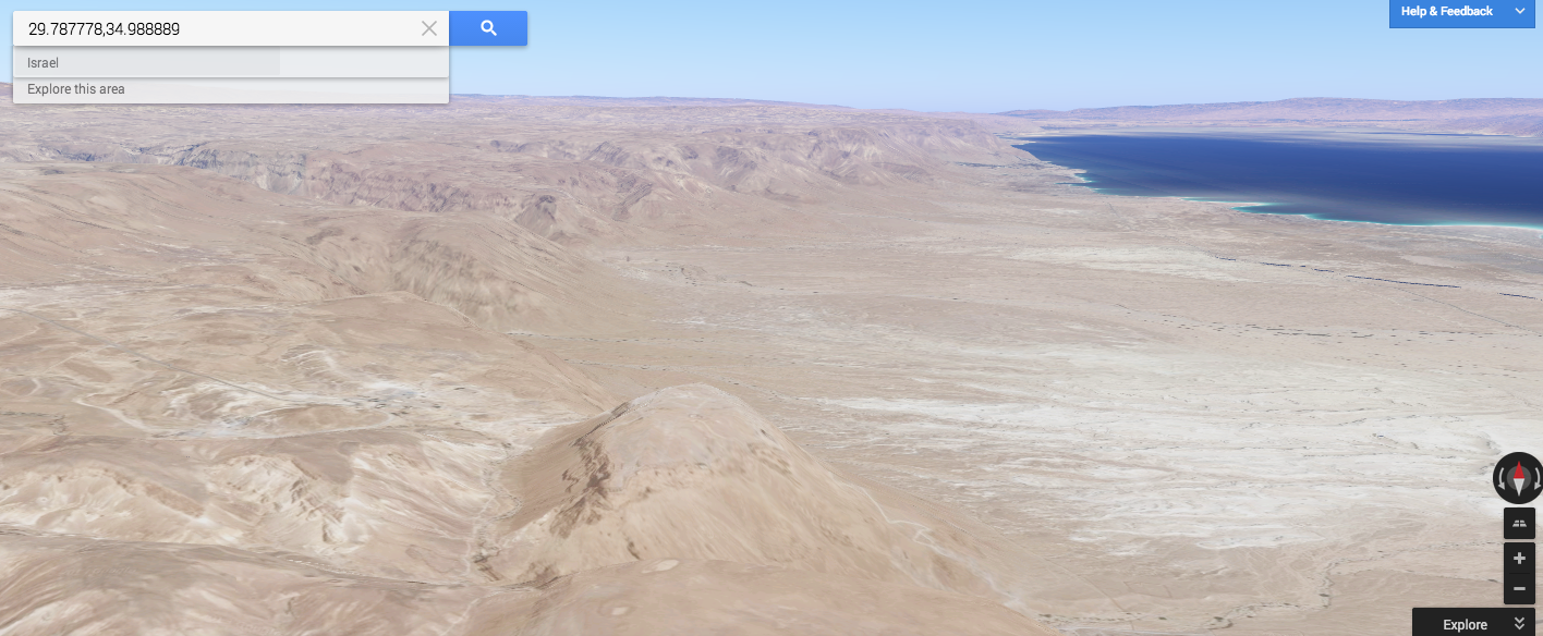
Next, we have an picture of the western side of the Dead Sea. In the foreground, you can see Herod's fortress of Masada. For everyone that has been to Masada, you have probably stood on the northern end of the plateau and taken almost this exact same picture. (And, for those of you who have a mental image of the Dead Sea that appears to be "dead", think again. The water in the Dead Sea is really that color of blue.)
Finally, we have a picture looking east down the Valley of Elah. This valley is mostly known as the location where David slew the Philistine giant, Goliath. In the story, the Israelites were on the ridge on the left side of the picture, and the Philistines occupied the ridge to the right. Running through the middle of the valley is a stream, which is where the young David picked up his ammunition for his battle. The two warriors met in that valley.

I'm looking forward to finding other sites and seeing how they are depicted. While this is no replacement for seeing actual photographs or especially visiting these sites for yourself, it is a wonderful resource that should be used by every Bible student.