Another Chance To Learn

Another Chance To Learn

delta_airlines.jpg

Two years ago, I was fortunate to be able to travel with my wife and my parents on one of Ferrell Jenkins' trip to Israel and Jordan. Well, it appears that I've been blessed enough to be able to do it again. I'll be leaving on Tuesday, September 4th and be gone for about 10 days. On my first trip, I was completely overwhelmed with my surroundings and being able to actually see so many of the places that I have read over and over all my life. Since that time, I have been fortunate enough to speak publicly about some of the places that I have visited and help others learn more about the Bible. On this trip, I want to build on top of what I have already learned. I want to try to look at things from a different perspective and further understand the Biblical lands.

Norm & Barbara Jo Webb, as well as my wife Tabatha and I, have started this website so that we can pass along information that we learn. We are hopeful that this information will be helpful to you in your personal studies and in Bible class teaching. Please do not hesitate to contact us if you have any questions. And, if you want to keep up with the changes on this site, you can like our Facebook Page or follow us on Twitter.

Israel Museum Walk-Through

Israel Museum Walk-Through

israel-museum.jpg

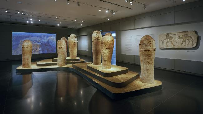
Only weeks after hearing word that the Israel Museum is now allowing photography inside the museum, we learn that they have been working with the Google Art Project to give you an interactive walkthrough of the entire museum. Although it is not the same as actually walking through the hallways, it is a lot cheaper. I have been able to visit the Shrine of the Book (which houses some of the Dead Sea Scrolls) and the enormous model of First Century Jerusalem. I'm looking forward to the opportunity in the near future to hopefully walk through these walls myself.

Photo courtesy of the Australian News.

Good News About Water

Good News About Water

IMG_2104.jpg

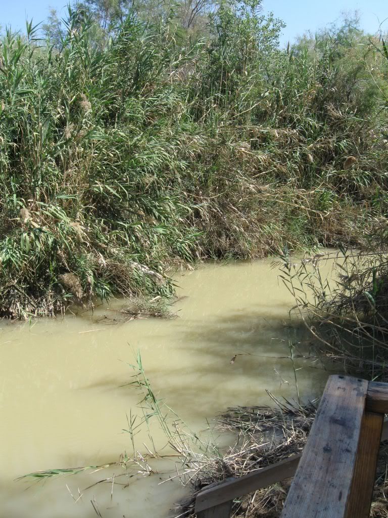
Throughout history, civilizations have lived and died by their proximity to water. The Mediterranean Sea. The Nile River. The Red Sea. The Sea of Galilee. The Jordan River. The Dead Sea. This is just a small list of the bodies of water that is mentioned in the Bible. When I traveled to Israel and Jordan in 2010, I was very interested in seeing many of these bodies of water. However, I was not altogether thrilled with what I saw. The water flowing through the Banias River in Caesarea Philippi was beautiful. Having recently tumbled down from the heights of Mount Hermon, it was crystal clear and sounded refreshing as it jumped and skipped over rocks and small waterfalls. The Banias is one of several streams that feed into the Jordan River north of the Sea of Galilee. The Sea of Galilee is a wonderful lake that is surrounded by hills on all sides. However, its surface elevation is very erratic and fluctuates up and down based on the amount of rain the area receives. At 211 meters below sea level, the Jordan River leaves the Sea of Galilee and meanders down to 423 meters below sea level at the Dead Sea. Along the way, the Jordan River transforms from a flowing river about 15 meters wide to a 2 meter wide sludge that creeps along by the time it gets to Qasr el-Yahud (picture at right), the traditional site of Jesus' baptism. Consequently, very little water is getting to the Dead Sea and is currently evaporating at a rate of one meter per year.

What's happening? Well, much of the water is being redirected from streams and tributaries leading to the Jordan River. It is being redirected mostly for domestic purposes (drinking water, crop irrigation, etc). While the reasons are legitimate, the shortage of water is having a profound impact to the area.

Luckily, people over there recognize the problem and are making changes to help. Through water recycling and conservation, Israel is preparing to add more water to the ecosystem. If they can continue this, and if the countries of Jordan and Syria can also get involved, this will help the situation tremendously.

If you are interested in keeping up daily with the water level on the Sea of Galilee, you might want to follow the Kinbot Twitter account.

HT: Ferrell Jenkins, Todd Bolen

Gihon Spring and En Rogel

Gihon Spring and En Rogel

IMG_2825_copyright.jpg

Knowing the geography of some of the Biblical locations allows you to understand and enjoy the stories even more. Such is the case with the locations of the Gihon Spring and En Rogel. Both of these locations were involved in David's appointment of Solomon as the next king of Israel. This story can be read in 1 Kings 1. As David was getting old, one of his sons, Adonijah took it upon himself to appoint himself as the successor to David. Adonijah rounded up a number of officials and threw a feast at En Rogel. When Nathan the prophet heard about it, he and Bathsheba approached David and told him what was happening. David immediately arranged for Solomon to be appointed king in a ceremony at the Gihon Spring.

By reading the Biblical account, it is not immediately obvious how close these two locations are. Depending on exactly where Adonijah was, they were probably around a half a mile apart. Clearly, they were close enough so that you could hear the loud noises from either location.

(NOTE: The picture above is a picture that I took in 2010 of the approximate location of En Rogel near the intersections of the Kidron and Hinnom valleys. The picture was taken from upon the southern end of the City of David.)

Currently, Luke Chandler is in Israel participating in an excavation of Khirbet Qeiyafa near the Valley of Elah. On a day off, he traveled to Jerusalem and posted a video showing these two locations and their relationship to this story in greater detail.


Mount Hermon and Caesarea Philippi

Mount Hermon and Caesarea Philippi

Mount_Hermon.jpg

Seth M. Rodriguez from BiblePlaces.com featured a picture today from Todd Bolen's Pictoral History of Bible Lands Collection. It is a fantastic aerial photograph showing the relationship between Mount Hermon and the town of Caesarea Philippi. A quote from Seth's blog reads:

In this photo, the immense size of Mount Hermon can be clearly seen while it dwarfs the remains of the ancient city of Caesarea Philippi (located at the bottom center of the photo). The ruins of the Crusader period castle of Nimrud can also be seen sitting on the ridge above Caesarea Philippi in the upper right quadrant of the photo.

This shot is helpful for a number of reasons. First, it gives the viewer an appreciation for the massive size of Mount Hermon. With its peak reaching an altitude of 9,230 feet (2,814 meters), it is almost three times the height of any other peak in the territory of ancient Israel. Secondly, it shows the geographical relation between the castle of Nimrud and Caesarea Philippi. Although I have visited both sites a number of times, the fact that they were both built on the same ridge escaped my notice until I saw this picture. However, those two reasons are not why I decided to feature this picture in today's post.

The third and most valuable reason is that it can be used effectively as an illustration when teaching or preaching on the Transfiguration of Jesus. The Transfiguration occurs in Matthew 16:28-17:9, Mark 9:1-9, and Luke 9:27-36. In each of those books, the event is immediately preceded by the discussion that Jesus had with his disciples where Peter declared, “You are the Christ, the Son of the Living God.” Matthew and Mark tell us that this conversation occurred in the region (or district) of Caesarea Philippi (Matt. 16:13; Mark 8:27).

A few days later, Jesus took Peter, James, and John up on a mountain where He was transformed in front of them. Matthew and Mark describe the location as “a high mountain” (Matt. 17:1; Mark 9:2), and Luke refers to it as “the mountain” with a definite article (Luke 9:28). Looking at this photograph it is not hard to see which mountain the gospel writers had in mind. If they were in the region of Caesarea Philippi and they went up a high mountain … indeed the most noteworthy mountain in the area … then it is not difficult to figure out which mountain was intended. Over the years, some have interpreted the “mountain” in these passages as referring to Mount Tabor on the eastern edge of the Jezreel Valley, but given the geographical indicators provided in the text, Mount Hermon is a more likely candidate.

To visualize the point Seth is making, examine the map below. The red marker is located on the city of Caesarea Philippi, the blue marker is on Mount Hermon and the purple marker is on Mount Tabor. Given the distance from Caesarea Philippi, I agree with Seth that Mount Hermon is a more likely candidate for the site of the Transfiguration than Mount Tabor.

[google-map-v3 width="640" height="480" zoom="12" maptype="terrain" mapalign="center" directionhint="false" language="default" poweredby="false" maptypecontrol="true" pancontrol="true" zoomcontrol="true" scalecontrol="true" streetviewcontrol="true" scrollwheelcontrol="false" draggable="true" tiltfourtyfive="false" addmarkermashupbubble="false" addmarkermashupbubble="false" addmarkerlist="33.247984,35.694387{}4-default.png{}Caesarea Philippi|33.412242,35.854912{}5-default.png{}Mount Hermon|32.68692,35.389194{}6-default.png{}Mount Tabor" bubbleautopan="true" showbike="false" showtraffic="false" showpanoramio="false"]

Excavations at Abel Beth Maachah

Excavations at Abel Beth Maachah

20120706_043048_SV06-MULLINSwebonly.jpg

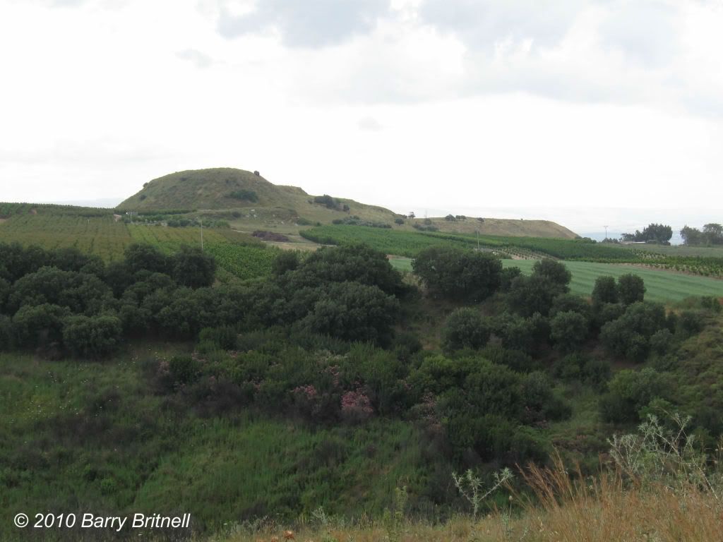
The city of Abel Beth Maachah is not one of the more readily identifiable locations in Israel, but it was a city of strategic importance during Old Testament times. When the Israelites invaded Canaan the land around Abel Beth Maachah was given to the tribe of Naphtali. Until this year, the tel had never been excavated. Even with the renewed interest in archaeology in Israel, this tel was over looked due to lack of interest or funding. In addition, its proximity to the Lebanese border has provided hesitancy with some. However, for a few weeks this summer, work started on the excavation and it has already produced some interesting results.

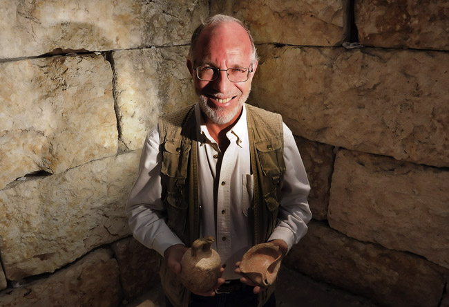
In the first information that I have read about it, Professor Robert Mullins from Azusa Pacific University discusses the findings from the initial dig.

As the digs continue, I am sure that more information will be found to help us understand the Biblical times.

(NOTE: The picture is of Abel Beth Maachah that I took in 2010. It is a view from the northwest.)

Picture of Professor Mullins courtesy of sgbtribune.com.

Hezekiah's Tunnel

Hezekiah's Tunnel

Hezekiahs-Tunnel-tb051803.jpg

Wayne Stiles has an excellent article this morning on Hezekiah's Tunnel. As Assyria began invading parts of the Kingdom of Judah, King Hezekiah decided to dig a tunnel from the Gihon Spring (located on the eastern side of Jerusalem near the Kidron Valley) to the western side. This allowed for the water to flow from the spring and make it accessible to the citizens of the city.

After these deeds of faithfulness, Sennacherib king of Assyria came and entered Judah; he encamped against the fortified cities, thinking to win them over to himself. And when Hezekiah saw that Sennacherib had come, and that his purpose was to make war against Jerusalem, he consulted with his leaders and commanders to stop the water from the springs which were outside the city; and they helped him. Thus many people gathered together who stopped all the springs and the brook that ran through the land, saying, “Why should the kings of Assyria come and find much water?”...This same Hezekiah also stopped the water outlet of Upper Gihon, and brought the water by tunnel to the west side of the City of David. Hezekiah prospered in all his works. - 2 Chronicles 32:1-4, 30

Even today, water still flows through this tunnel from the Gihon Spring to the Pool of Siloam. Tourists, if they don't mind getting a little wet, can walk the length of this tunnel.

Interior photograph of Hezekiah's Tunnel is courtesy of BiblePlaces.com.

Ancient Greek Road Uncovered in Thessaloniki

Ancient Greek Road Uncovered in Thessaloniki

slide_234942_1143823_free.jpg

Archaeologists have uncovered ancient Roman and Greek roads in the modern city of Thessaloniki, the location of the biblical city, Thessalonica.  While excavating for a new subway system through the city, a 230 foot section of marble paving stones were unearthed, which archaeologists estimate to be around 1800 years old.  Below this road, they discovered another road built by the ancient Greeks dating back another 500 years.  These roads were part of the city's main artery.  The Huggington Post reports,

The excavation site was shown to the public on Monday, when details of the permanent display project were also announced. Several of the large marble paving stones were etched with children's board games, while others were marked by horse-drawn cart wheels.

Also discovered at the site were remains of tools and lamps, as well as the bases of marble columns.

Viki Tzanakouli, an archaeologist working on the project, told The Associated Press the Roman road was about 1,800 years old, while remains of an older road built by the ancient Greeks 500 years earlier were found underneath it.

"We have found roads on top of each other, revealing the city's history over the centuries," Tzanakouli said.

"The ancient road, and side roads perpendicular to it appear to closely follow modern roads in the city today."

It is possible that Paul traveled on the ancient Grecian built road as he entered Thessalonica:

"Now when they had passed through Amphipolis and Apollonia, they came to Thessalonica, where there was a synagogue of the Jews."

The city of Thessalonica sat at the intersection of two major Roman roads, one of which connected to the Ignatian Way that led eastward out of Rome.  The ancient Roman and Greek roads recently discovered in Thessaloniki may have been a section of this main artery leading to Rome.  Unfortunately, the ancient city of Thessalonica is buried beneath the modern city, making excavation difficult.  The development of the subway system has given opportunity to archaeologist to make some significant discoveries. [google-map-v3 width="640" height="480" zoom="8" maptype="terrain" mapalign="center" directionhint="false" language="default" poweredby="false" maptypecontrol="true" pancontrol="true" zoomcontrol="true" scalecontrol="true" streetviewcontrol="true" scrollwheelcontrol="false" draggable="true" tiltfourtyfive="false" addmarkermashupbubble="false" addmarkermashupbubble="false" addmarkerlist="40.64522,22.944946{}1-default.png{}Thessaloniki, Greece" bubbleautopan="true" showbike="false" showtraffic="false" showpanoramio="false"]

Welcome!

20100508 007A little over two years ago, my wife and I took a trip to Israel and Jordan to see some of the lands mentioned in the Bible.  Those ten days were amazing and completely changed the way that we read the Bible.  We used to read over the geographical locations.  Now, we pause to consider how that relates to the stories.  For most of my life, I knew the Bible stories.  Now, I understand them. I have been able to answer many Biblical questions that I did not even realize that I needed to ask.  Questions like:

  • When Rahab assisted the spies in getting out of Jericho, she told them to hide in the mountain.  Why did she tell them that?
  • When David fought Goliath, what was the vantage point of the Philistines as they watched their champion fall to the ground?
  • When Jesus told his disciples the story of the Good Samaritan, he referenced the road between Jerusalem and Jericho, but didn't mention any details about the road.  Why?

We have built this site to help you get the answers to some of those questions as well.  Of course, this website will be a continual work in progress.  We will add new information to it and post those updates to our Facebook page.  Feel free to ask us any questions that you may have.  If we don't know the answer, we'll try to go and find it.

In the meantime, enjoy the site and remember to explore Bible lands.