

 Bible students contemplate lines on maps that indicate the route scholars believe Paul took on his second journey. These lines on Bible maps are not simply a “best guess” at the route of Paul. There is evidence to support the geographical markings, and this evidence is obvious if the Bible student has some familiarity with the geography and the recent discoveries in the area.
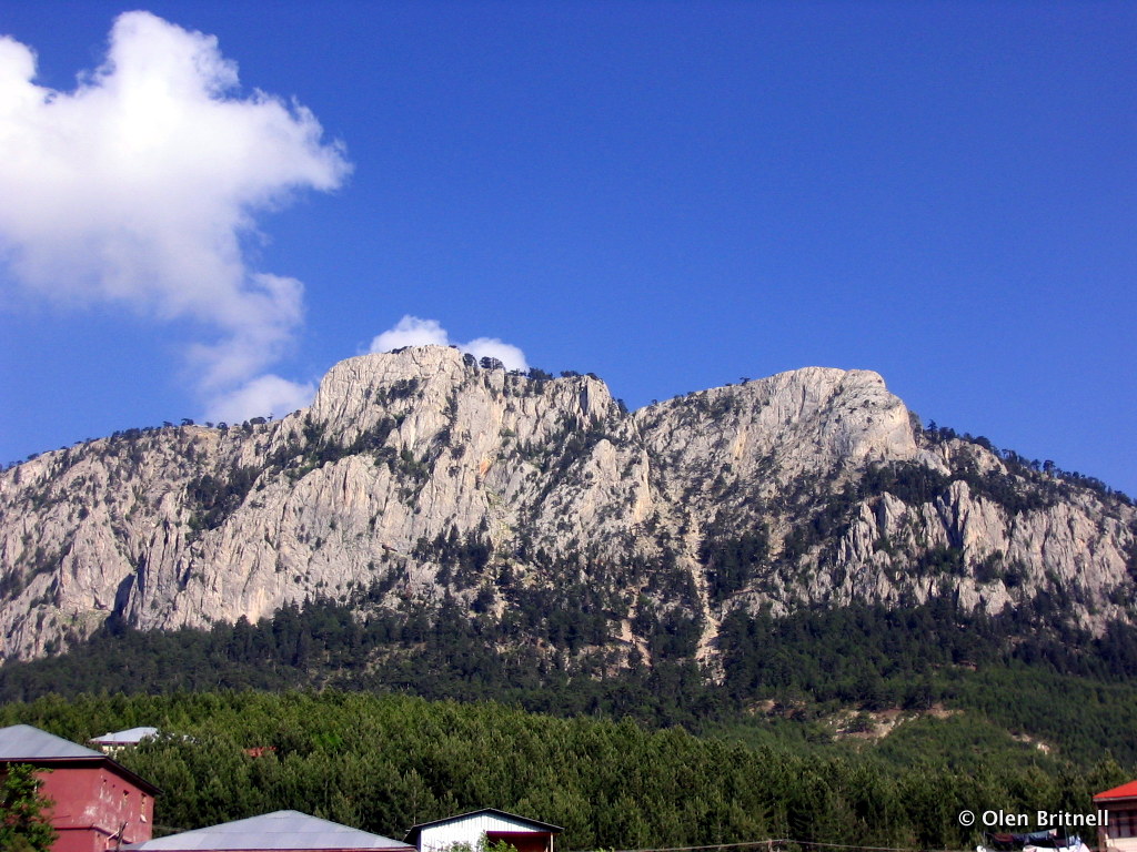
 For instance, the Bible tells us that Paul left from Antioch and “went through Syria and Cilicia…” (Acts 15:41) That tells us the general area Paul passed through, but to understand his route, we must study the landscape. The Taurus Mountains lie between Antioch and Cilicia, and many of those peaks are rocky and rise above 10,000 feet, making the area extremely difficult to cross. However, on closer inspection, you will notice that there is a gap in the mountains. This gap is referred to as the “Cilician Gates”. It allows for much easier passage though the area than any other place in close proximity. The Cilician Gates are only about 30 miles south of Tarsus, which was one of the great crossroad cities of the time. The apostle Paul referred to Tarsus as “…no mean (insignificant) city…” (Acts 21:39), partially due to the fact that it was located so close to this route through the Taurus Mountains.
Even today the major highway of the area follows a route in the only gap in the Taurus Mountains in the area…the Cilician Gates. This is the way people crossed this territory between Antioch and Tarsus in Bible times, and the way it is crossed today.