Viewing entries tagged
Jericho

From Galilee to Jerusalem

Wow...we have had a busy few days. So busy, in fact, that I have been unable to write a blog post. But, our group has made it safely to Jerusalem and we are enjoying our time together.

On Thursday, we travelled north up the Hula Valley and visited the sites of Hazor, Abel Beth Maacah, Dan, and Caesarea Philippi. After lunch, we traveled through the Golan Heights and were able to enjoy the view into Syria from Mount Bental. We ended our day by seeing the first 

Friday's stops included Capernaum, a boat ride on the Sea of Galilee, Nof Ginnosar, and an opportunity to step into the sea. We were able to have lunch at a local restaurant to have "St. Peter's Fish". We ended our day by climbing to the top of Mount Arbel and viewing the entire Sea of Galilee. It was a wonderful day.

This morning, we left the serenity of the area of Galilee and headed toward Jerusalem. On the way we made stops at Jezreel, Spring of Harod, Bet She'an, Jericho, and the baptismal site. Our arrival in Jerusalem was met with much cooler temperatures than what we experienced to our north. It was a welcome relief. 

Not only is the group doing great, but they are an absolute joy to be around. Tomorrow, we head towards the Dead Sea.

Down The Rift Valley

Down The Rift Valley

image4.jpeg

This evening, we arrived in the beautiful city of Jerusalem. Unlike what is being reported on the news right now, it is exactly as I remember it from my last visit. In fact, when we arrived at Jericho today, it was more crowded with tourists than I have ever seen it. So, whatever is being reported back home isn't exactly what is happening here on the ground. In other words, as much as we all appreciate your care and concern, we are doing just fine. I always hate leaving Galilee, but that is what we were required to do to keep on our schedule. Very soon, we found ourselves at Tel Jezreel, the site of the palace so Ahab and Jezebel. From the hillside, you can see the locations of many Biblical stories.

Shortly thereafter, we arrived at the Spring of Harod. Gideon narrowed his army to 300 men by giving them a test here. The water was actually flowing a little bit. Since we are at the end of the dry season, I had not expected this.

A visit to Bet She'an was next on the agenda. The amount of ruins that are visible here is overwhelming. By claiming to the top of the tel, you get a good appreciation for the strategic importance of this location.

By driving down the Jordan Rift Valley, we found ourselves at Jericho. Whenever we stop there, I want to talk to the group for an hour discussing all that happened here. But, it was very hot when we arrived. So, I abbreviated my comments and then finished them up when we were all back in our touring coach.

After a quick visit to the traditional baptismal site, we made our way "up to Jerusalem". We will spend the next five nights here and enjoy all of the sites in this wonderful city.

We are all having a great time and the sarcasm is getting more and more intense. I can't wait to spend time with all of them again tomorrow.

Until then, shalom.

Why Study Biblical Geography? Part I

The Spring of Harod, at the foot of Mount Gilboa.Sometimes people ask me, "Why do you study Biblical geography so much?" Generally, I study Biblical geography because it helps me to understand the Bible more. But, to answer answer the question specifically, I can think of three reasons. I will cover these three reasons in the next few posts.

Reason #1 - I study Biblical Geography to better understand God's people.

As Moses was giving final directions to the nations of Israel, he states:

Hear, O Israel: The Lord our God, the Lord is one. You shall love the Lord your God with all your heart and with all your soul and with all your might. And these words that I command you today shall be on your heart. You shall teach them diligently to your children, and shall talk of them when you sit in your house, and when you walk by the way, and when you lie down, and when you rise. You shall bind them as a sign on your hand, and they shall be as frontlets between your eyes. You shall write them on the doorposts of your house and on your gates. - Deuteronomy 6:4-9

God wanted His people to teach their children about Him as they walked by the way (or, as they walked across the land). Three times a year, the nation of Israel were required to go to Jerusalem for the feasts. As they made those trips, it would provide a number of opportunities for the parents to talk to their kids about God.

As they passed the Spring of Harod, the could explain how God used Gideon and a small army of only 300 men to take on and defeat the Midianites.

As they passed Mount Carmel, they could explain how God and Elijah took on the prophets of Baal and proved that He was the one and only true God.

As they passed the ruins of Jericho, they could explain how God used His power to render a fortified city defenseless against His people.

By studying Biblical Geography, we can better understand God's people and how they taught their children.

In my next two posts, I'll discuss two other reasons why we need to study Biblical geography.

Words Mean Something, Part 2

The modern city of Jericho and the wilderness rising to the west. Photo from BiblePlaces.com. In a previous post, I made reference that the words in the Bible mean something. By carefully reading all of the words, a clearer understanding of Scripture can be found. I was recently teaching a class on the book of Joshua in which we were discussing Israel's preparations for attacking the city of Ai in Joshua 7. The passage in question involves a conversation between Joshua and member of his army. This conversation took place in Gilgal, in an area on the floor of the Jordan Rift Valley near Jericho. Notice the language that the men use in describing the location of Ai in reference to where they currently are located.

Joshua sent men from Jericho to Ai, which is near Beth-aven, east of Bethel, and said to them, “Go up and spy out the land.” And the men went up and spied out Ai. And they returned to Joshua and said to him, “Do not have all the people go up, but let about two or three thousand men go up and attack Ai. Do not make the whole people toil up there, for they are few.” So about three thousand men went up there from the people. And they fled before the men of Ai, and the men of Ai killed about thirty-six of their men and chased them before the gate as far as Shebarim and struck them at the descent. And the hearts of the people melted and became as water. - Joshua 7:2-5

The picture at the top of this post is from BiblePlaces.com. It is an aerial picture south of Jericho looking north. Be sure to notice the dramatic elevation change from the city of Jericho as the terrain rises into the Central Mountain range. Now, go back and read the passage again. As you can tell, Joshua and his men described the situation perfectly from their point of view.

Words truly do mean something. Don't skip over them when reading these Biblical stories.

Spring in the Jordan Valley

As I speak to people about the lands of the Bible, I am often met with surprise when I discuss the rich and fertile areas of Israel. And, while there are places like the wilderness and the Negeb that are very dry, much of the area is well watered. Recently, I watched a video by Amir Aloni of the Jordan Valley. He took the footage for the video using a drone which flew over many of the fields in the area. I encourage you to watch it as well.

[vimeo https://vimeo.com/123064814]

When I saw this video, I was reminded the passage in Genesis 13 in which Lot chose to settle in the fertile Jordan Valley when he separated from Abraham.

So Abram went up from Egypt, he and his wife and all that he had, and Lot with him, into the Negeb. Now Abram was very rich in livestock, in silver, and in gold. And he journeyed on from the Negeb as far as Bethel to the place where his tent had been at the beginning, between Bethel and Ai, to the place where he had made an altar at the first. And there Abram called upon the name of the Lord. And Lot, who went with Abram, also had flocks and herds and tents, so that the land could not support both of them dwelling together; for their possessions were so great that they could not dwell together, and there was strife between the herdsmen of Abram's livestock and the herdsmen of Lot's livestock. At that time the Canaanites and the Perizzites were dwelling in the land. Then Abram said to Lot, “Let there be no strife between you and me, and between your herdsmen and my herdsmen, for we are kinsmen. Is not the whole land before you? Separate yourself from me. If you take the left hand, then I will go to the right, or if you take the right hand, then I will go to the left.” And Lot lifted up his eyes and saw that the Jordan Valley was well watered everywhere like the garden of the Lord, like the land of Egypt, in the direction of Zoar. (This was before the Lord destroyed Sodom and Gomorrah.) So Lot chose for himself all the Jordan Valley, and Lot journeyed east. Thus they separated from each other. - Genesis 13:1-11

One Year Ago - The Lowest Place on Earth

Herod's Palace at Masada NOTE: I am continuing my series of retrospective posts on the our tour one year ago. I invite you to start at the beginning and read through all of them.

A year ago today, we went to the lowest place on earth, the Dead Sea. This beautiful body of water does not live up to its name...it exceeds it. The water in the Dead Sea is a beautiful shade of blue and is actually quite clear for several feet.

We began the day by driving down to Masada, where Herod built a beautiful palace. Years later, nearly a thousand Jewish zealots held off the Roman army for a couple of years by using this "stronghold".

Our next stop was at En Gedi, for a short walk up a path to a waterfall. It is interesting to see the abundance of water in this place given the arid environment around it. It is no wonder why David fled to this location while being pursued by Saul.

After a stop at Qumran (where the Dead Sea Scrolls were found), we visited one of the oldest cities in the world, Jericho. You can visualize so many Biblical stories from this location.

We finished our day by trying to take a dip in the Dead Sea. Of course, everyone just floated to the top. But, it was a great day to end the day.

Tomorrow: We visit the Old City.


2015 Israel Poster B

Have you been enjoying these posts on last year's tour? Are you interested in traveling with me this year? Then, I would love to have you join me. Our 12-day tour is scheduled for October 12-23. We will stay one night on the Mediterranean Sea, three nights on the shores of the Sea of Galilee and five nights in beautiful Jerusalem. During the day, we will visit dozens of sites that will enhance your understanding of the land and of the Biblical stories that take place in them. Reservations are coming in, but we still have some availability! This is a first-class tour with many extras thrown in that many Israel tours overlook. If you are interested, I encourage you to read the itinerary and contact me personally for more details.


Podcast #3 - God Stopped The Waters At Adam

[soundcloud url="https://api.soundcloud.com/tracks/191530415" params="auto_play=false&hide_related=false&show_comments=true&show_user=true&show_reposts=false&visual=true" width="100%" height="450" iframe="true" /] The Israelites had survived Pharoah chasing them toward the Red Sea. They had spent time at Mount Sinai. They had survived forty years of wandering in the wilderness. But before they could begin their conquest of the Promised Land, they had one more barrier to cross...the Jordan River. How did this happen? Joshua 3 tells us this incredible story. And that is what we will be discussing on today's program.

Note: If you are reading this post in an email, you can visit the Podcast page on the Exploring Bible Lands website to listen to the podcast.


Podcast Links Joshua 3 - Bible Gateway

Podcast #1 - Samuel's Farewell Address

[soundcloud url="https://api.soundcloud.com/tracks/186283773" params="auto_play=false&hide_related=false&show_comments=true&show_user=true&show_reposts=false&visual=true" width="100%" height="300" iframe="true" /] In 1 Samuel 12, as Samuel is growing old, he takes the time to address the nation of Israel one last time. At the end of his speech, he asks God for a sign. God then sends a thunderstorm. The text then tells us that the people "greatly feared the Lord and Samuel". Why? Well, to fully understand the answer to the question, you need to know a little bit about the geography of Israel. That is what we will discuss in today's program.

You can subscribe to this podcast by searching for "Exploring Bible Lands" in iTunes, or by using our podcast feed URL (http://feeds.soundcloud.com/users/soundcloud:users:132866789/sounds.rss) in any podcast subscription application.


Podcast Links 1 Samuel 12 - BibleGateway.com 2015 Israel Tour Exploring Bible Lands' Facebook Page

Mt. of Temptation

3_Mt_ofTemptation_1 The Mount of Temptation fringes the Judean Wilderness just north of the Dead Sea, where it looms over the site of Jericho (Tel es-Sultan).  Because tradition states that, following His baptism, Jesus ascended this mountain to be tempted, a beautiful, gravity-defying monastery has been built on the mountainside.  Above this is the fortress some believe to be Ptolemy’s hideaway, Dagon, mentioned by Josephus—though others conjecture this may be a later Crusader structure.

Samuel's Farewell Address

17_2_TelBetShean_Valley_smallIn 1 Samuel 12, Samuel speaks to the people of Israel about some of the decisions that they have made, primarily concerning the fact that they had requested a king (when God was already their king). However, he states that if the people and their king will obey the Lord, then all will be well. However, if they don’t, then “the hand of the Lord will be against you and your king”. Then, Samuel performs a sign. He asks God for thunder and rain. And, the Lord provides it.

"Now therefore stand still and see this great thing that the Lord will do before your eyes. Is it not wheat harvest today? I will call upon the Lord, that he may send thunder and rain. And you shall know and see that your wickedness is great, which you have done in the sight of the Lord, in asking for yourselves a king.” So Samuel called upon the Lord, and the Lord sent thunder and rain that day, and all the people greatly feared the Lord and Samuel. - 1 Samuel 12:16-18

Why did the people “greatly fear” them? Well, you have to know a little bit about the geography and climatology of the land to understand.

Location of the Sign Slide06
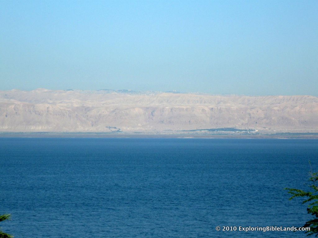
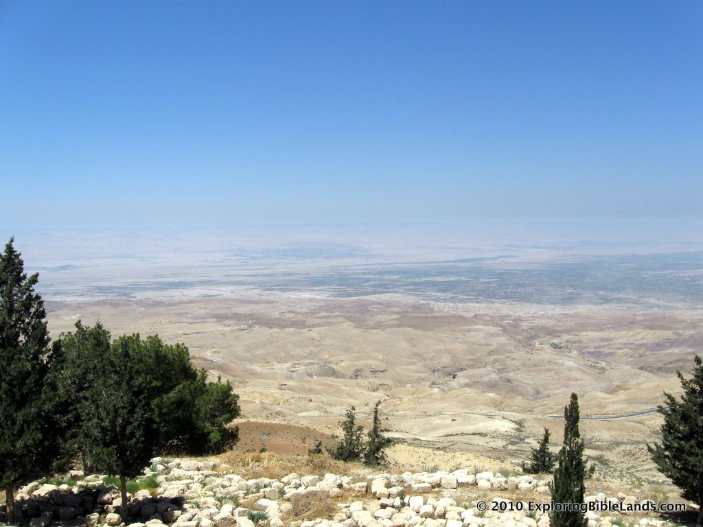
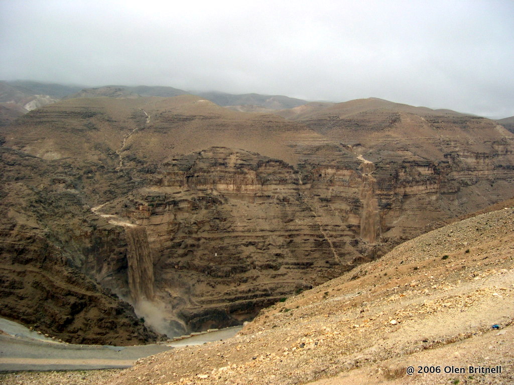
The people were assembled at Gilgal. (NOTE: I realize that there are a couple of different locations attributed to Gilgal. And, I realize that “a gilgal” could have been something that was built. But, I believe that in this passage we are talking about an actual location). Gilgal was location approximately 4-5 kilometers away from Jericho in the base of the Jordan Rift Valley.

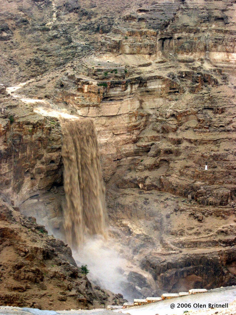
As winds come off of the Mediterranean Sea, they reach the Central Mountain Range and rise. As the air rises, it cools and water droplets condense and eventually fall as rain. Therefore, the Central Mountain Range (including the cities of Jerusalem, Bethlehem, Samaria, etc) get about 26 inches of rain per year. However, as the winds top of the Central Mountain Range, they descend into the Jordan Rift Valley. In doing so, the air warms and the water dries up. Consequently, the city of Jericho (which is located about 10-12 miles from Jerusalem) only gets 4-6 inches of rain per year.

So, why were the people afraid? Because they realized that God made it rain in a place that doesn’t get that much rain.

But, I think that there is another reason.

Time of the Sign Slide13
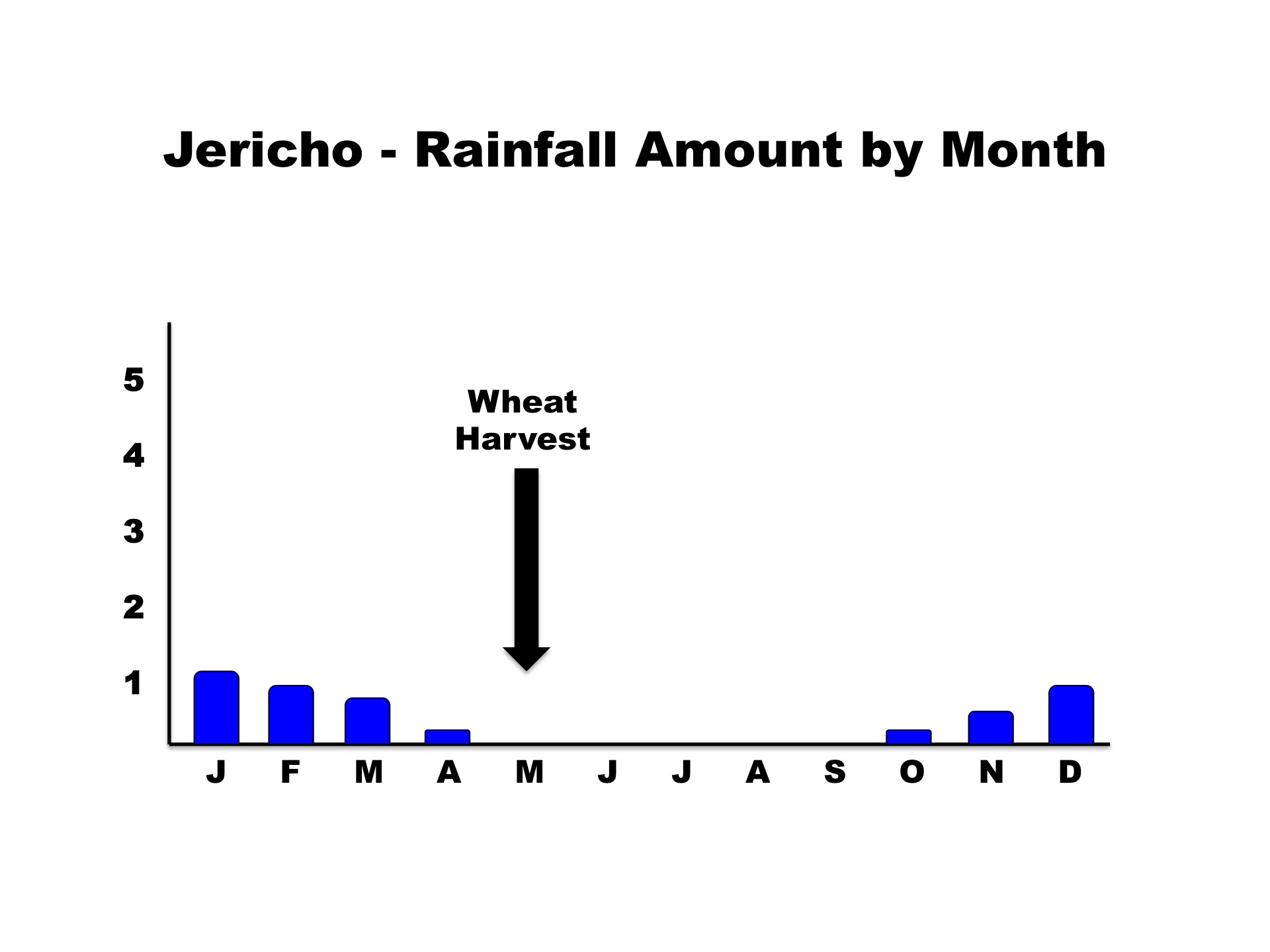
Did you catch that extra piece of information that Samuel stated in his speech? He said that it was the time of the wheat harvest. What does that mean?

Well, the little rain that does fall in the Jordan Rift Valley falls between the months of October and April. The wheat harvest is in May (and may go into June). The people knew that God had made it rain at a time of year in which it never rains.

When the people saw that the rain fell in a place that rarely gets rain and at a time in which it never gets rain, they knew that this was a sign from God. And consequently, they were greatly afraid.

By better understanding the lands of the Bible, you can better understand the stories in the Bible.

Recently, I presented a lesson on this topic at Capshaw church of Christ. You are welcome to listen to it and let me know if you have any questions.

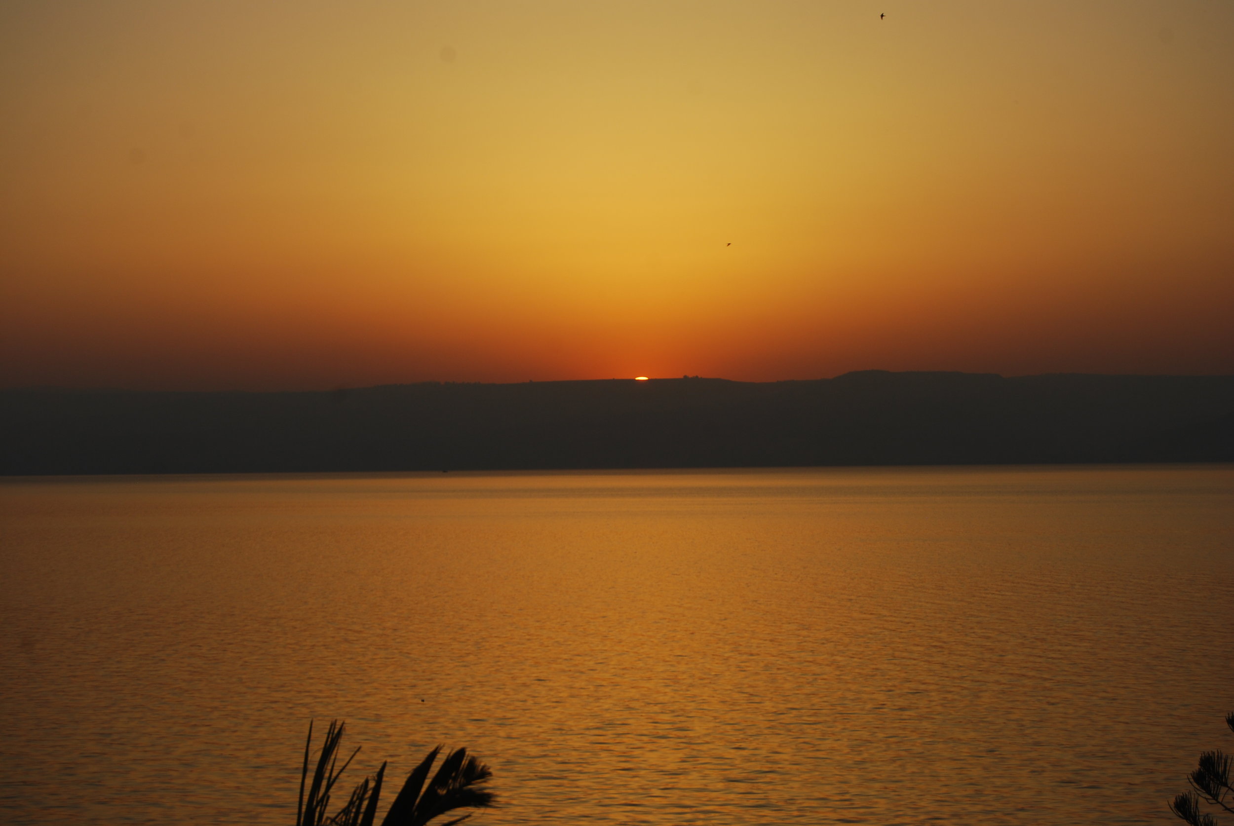
(NOTE: The picture at the top of the post is from Trent and Rebekah Dutton. You can see all of their pictures at http://www.simplebiblehistory.com. The picture is taken from the Central Mountain Range looking east across the Jordan Rift Valley toward the Trans-Jordan Plateau.)

The Lowest Place On Earth

The Lowest Place On Earth

ibex.jpg

masadaToday was spent the entire day around the lowest place on the earth, the Dead Sea. After breakfast, we headed toward Masada. Our goal was to beat the crowds and the heat of the day. We arrived around 9:15 and went to the top. This is a great stop. This site is one of the top tourist attractions in Israel. From a Biblical perspective, it is interesting to see the lifestyle of King Herod and knowing that it was this man's family that was the ruling party in the First Century. Our next stop was En Gedi, which included a brief hike up to a waterfall. During David's life, he went to En Gedi and after visiting the site, you know why. In the middle of the Wilderness of Judea, it was this location that had water. Even today, water continually flows from the mountains as it makes its way to the Dead Sea.

Traveling north up the coast, we found ourselves at Qumran, the site where the Dead Sea Scrolls were found. We enjoyed learning about the Essenes and their lifestyle in this arid climate.

Our next stop was at the traditional baptismal site of Jesus. The Bible tells us that John the Baptist was baptizing at "Bethany beyond the Jordan", which means that John was baptizing at some location on the other side of the Jordan from where we were located. Due to various reasons, the River Jordan is very small through here. It is only about 20 feet wide and about 2 feet deep. In many ways, it is very depressing. However, the Israelis, Palestinians and Jordanians are all working on this problem.

(Side note: While we were visiting this site, we learned that the mother of our driver had passed away. The travel company made arrangements for a new driver to meet us within a few minutes. I feel bad for Fawzi, our driver. I have known him for about five years and know that he and his family are going through a rough time right now.)

dead_seaJericho was next on our list. This site is very special for me because so many Biblical sites took place here. We discussed many of these events as well as the architectural finds that have been made here.

Having a smaller group (about 30) has its advantages. We were able to squeeze some extra time in our schedule to take everyone to the Qumran kibbutz and allow them the opportunity to float in the Dead Sea. And, they did!

Overall, another great day today. Tomorrow will be a walk around the Old City of Jerusalem which is always very interesting. Until then...

He Walked To Jerusalem

Jericho and Jerusalem from the Dead Sea Spa Hotel in Jordan.Frequent readers of this blog may already recognize the picture above. I have used it a couple of times. It is a picture taken from the Dead Sea Spa Hotel on the eastern shore of the Dead Sea. We are looking across the Dead Sea at the cities of Jericho (lower) and the outskirts of Jerusalem (on top of the hill). I like this picture because it helps us to understand passages better. For instance, consider this verse:

When He had said this, He went on ahead, going up to Jerusalem. - Luke 19:28

This verse follows the account of Jesus' interaction with Zacchaeus in Jericho. It is only 13 words long and simply says that he went "up to Jerusalem". Although the passage doesn't mention how he went up, we can probably safely assume that he walked. He walked to Jerusalem.

The elevation of Jerusalem is around 2500 feet ABOVE sea level. The elevation of Jericho is around 800 feet BELOW sea level. The distance between the two cities is about 12-14 miles (depending on the exact path that you took). This picture was taken in late April, which is a little after the time of year of which this passage is written. The latter rainy season has ended, so there is nothing but clear skies.

14 miles. Uphill. In the direct sunlight. He walked. And, of course, He knew that He was walking to his death.

Knowing the land of the Bible helps you understand the Bible.

Perhaps in later posts, I'll talk about more paths that were walked in the Bible.

The Ark around the City of Jericho

Archaeological work at Tell es-Sultan, otherwise known as ancient Jericho.NOTE: This is the third post of a series in which we are discussing some of the locations where the Ark of the Covenant was present. We've discussed the Plains of Moab and the Jordan River. After the Israelites entered the Promised Land, they set out to fulfill the commandment that God had given to them. They needed to drive out and destroy all of the inhabitants of the land of Canaan. In doing so, God would be with them and deliver the land to them. The Israelites put their sights on Jericho.

The city of Jericho (also known as "The City of Palms") is mentioned several times in Scriptures. Among them are:

  • Elijah and Elisha went through the city - 2 Kings 2:1-6
  • Jesus healed the blind man Bartimaeus in the city - Mark 10:46-52
  • Zacchaeus lived in the city - Luke 19:1-10

Jericho is located about 10 kilometers (6 miles) west of the Jordan River at an elevation of about 260 meters (850 feet) below sea level. Because of the warm tropical conditions, King Herod built a large palace in Jericho. The city is only about 15 miles from Jerusalem, but it is over 3000 feet lower in elevation. And due to the geography, Jericho only receives about one-fourth of the annual rainfall as Jerusalem.

At the time of the conquest, Jericho was a fortified city surrounded by a casemate wall. The harlot Rahab had a house on this wall.

Then she let them down by a rope through the window, for her house was on the city wall; she dwelt on the wall. - Joshua 2:15

For six days, the Israelites carried the Ark of the Covenant from Gilgal (where they were encamped) and walked around the city of Jericho. On the seventh day, the Ark of the Covenant led them around the city of Jericho seven times. After which, they blew their trumpets and the walls of the city were breached. It was a glorious victory for God and His people.

The Ark in the Plains of Moab

View looking west from Mount Nebo at the Plains of Moab across from Jericho.When the Israelites were encamped at Mount Sinai, God gave instructions to build a gold-plated, wooden box. This box became known as the Ark of the Covenant and it remained in the possession of the Israelites for hundreds of years. They carried the Ark before them and it led them into battle. I thought that it would be interesting to take a look at some of the places where the Ark resided and discuss them in a series of posts. After wandering in the wilderness for 40 years, the Israelites approached the land of Canaan from the east and temporarily settled in the Plains of Moab. Moses ascended to the top of Mount Nebo where God showed him the land that was being given to the nation of Israel. After Moses died, the Israelites stayed in the Plains of Moab while they mourned his death.

And the children of Israel wept for Moses in the plains of Moab thirty days. So the days of weeping and mourning for Moses ended. - Deuteronomy 34:8

The plains of Moab stretched north-to-south along the eastern side of the Jordan River, opposite from the city of Jericho. The land is rather flat and ranges from 5-10 miles wide before rising dramatically into what we commonly call the Trans-Jordan plateau. A majority of it lies below sea level, but despite the arid climate, crops and agriculture flourish.

Later, we recognize this location as the same area where Elijah was taken into Heaven in a whirlwind. In New Testament times, this was part of what we know as Perea. The location of Bethany beyond the Jordan was also in this same area.

Adam

Most of the time, when we think of Biblical Adam, we think about the first man. However, did you know that there is a location in the Bible called "Adam"? It is mentioned only one time, and God used that location to demonstrate his power and help deliver His promise to His people. Do you remember where you read about it? If you can't remember, don't feel too bad. I've only recently remembered while it while doing some personal study. You can read about it and see it on a map here.

Snow and Rain in Jerusalem

Water pours from the Central Mountain Range into Wadi Qelt on April 2, 2006.  As I have mentioned before, people who have never been to Israel often think of it as a very warm and dry place. It is true that there are some areas of the country that are desert-like, most notably the Negev in the southern part of the country. In addition, there are times during the summer in which the periods of rain are very few and far between. For instance, Jerusalem rarely gets any rain between the months of April and October. Still, you have to remember that Jerusalem is about 750 meters (2500 feet) in elevation and during the winter, can receive a lot of rain. And, on occasion, receive snow. Water pouring over the ridge into Wadi Qelt from rains on April 2, 2006.Within the past day, much of the land of Israel has received copious amounts of rain. From the Galilee area, down the central mountain range, and through Jerusalem, many centimeters of rain has fallen. And, in many areas, this has fallen as snow. Reports from Mount Hermon state that many areas of the mountain have received over a meter of snow. It has been snowing in Nazareth and this morning, many parts of Jerusalem have received about two centimeters (about an inch) of snow. The Jerusalem Post posted a number of pictures of the rain, flooding and snowfall, which I encourage you to view.

Washed out road caused by flooding in Wadi Qelt on April 2, 2006.  (Note the mangled guard-rail that disappears into the dried mud flow.)In 2006, my parents were traveling with Ferrell Jenkins and were able to witness this phenomenon. On April 2, the city of Jerusalem received over 4 inches of rain. The water drained out of the metropolitan area and rushed into Wadi Qelt. (Wadi Qelt is a valley and stream that run east from Jerusalem down toward Jericho. It is very deep and in many areas it is impassible to someone traveling north to south.) Wadi Qelt flooded in many places and washed out some roads when it drained out into the valley. I have attached a few pictures from that event.

When I look at the pictures, I can't help but think of the example that Jesus used as he encouraged the people to listen to him.

“Therefore whoever hears these sayings of Mine, and does them, I will liken him to a wise man who built his house on the rock: and the rain descended, the floods came, and the winds blew and beat on that house; and it did not fall, for it was founded on the rock. But everyone who hears these sayings of Mine, and does not do them, will be like a foolish man who built his house on the sand: and the rain descended, the floods came, and the winds blew and beat on that house; and it fell. And great was its fall.” And so it was, when Jesus had ended these sayings, that the people were astonished at His teaching, for He taught them as one having authority, and not as the scribes. - Matthew 7:24-29

2012 Israel Trip - Day Eight

2012 Israel Trip - Day Eight

DSCN0977.jpg

Today was spent in an around the Dead Sea in the Wilderness of Judea.  We had a surprise visit this morning at Qasr al-Yahud, which is near the traditional location of the baptism of Jesus.  In the Gospels, we read that John was baptizing at "Bethany beyond the Jordan".  So, John was actually baptizing at a location on the other side of the Jordan River.  However, this is as close as we can get without going into the country of Jordan.  Due to irrigation and water control, the river at this point is very narrow compared to what it was in Biblical times. We then traveled down to the vacation home of Herod the Great, Masada.  The history of Masada is something that every person should study.  Consequently, I won't go into that now and leave that to your personal study.  Masada is never mentioned by name in the Bible, however it might have been referenced.  The word "masada" means fortress.  While in the area, the scriptures mention that David visited a fortress on three different occasions.  In addition, David mentions a fortress in four of his psalms.  So, it is highly possible that David visited here.  I had one other interesting experience at Masada, which I'll discuss later.

From there, we traveled north for a brief stop at En Gedi (where David hid while he was being pursued by Saul), Qumran (the location of the discovery of the Dead Sea Scrolls) and Jericho.  I've been to Jericho twice and it is one of the highlights of my trip.  The tel that we visit is from Old Testament Jericho (New Testament Jericho was in a slightly different location).  From that tel, you can see the size of the city, so you know exactly how far the Israelites marched as they circled the city for seven days.  You can also envision Rahab, who built her house on the wall of the city.  She could look out her window and see the Israelites as the encamped in the plains of Moab across the Jordan River.  It is a fascinating place.

Tomorrow is an early day.  We have to leave the hotel at 7:00am in order to be in the Old City in time to enter the Temple Mount by 7:30.  So, I'll need to get to bed soon.

However, back to Masada.  I'm an amateur hiker.  I really enjoy hiking in the Smokies and have hiked many miles there.  At Masada, you have two choices to get to the top.  The first choice is a tram lift that will take you to the top in about 3 minutes.  The second is the traditional route (the same route that the people of the time would have used) via the "Snake Path".  The trail is only 2 kilometers long, but it climbs over 350 meters in that distance.  (I'll leave it as a math exercise for you to figure out how steep that is.)  There were about 10 others in the group that wanted to hike the Snake Path, so I thought that I would give it a shot.  Well, I made it.  However, it wasn't a complete success.  When we left, the temperature was about 30 degrees Celcius (another math exercise for you) with no clouds (rain rarely falls here) and very little wind (we are at the lowest place on earth).  I made the trip up okay, but soon after arriving at the top, I started to get tingling feelings in my fingers.  Since that is one of the first signs of heat exhaustion, I knew that I needed to take care of myself quickly.  I took the first tram back to the visitor's center and immediately bought a coke.  I sat down in the cool air and began to recover.  Our outstanding tour guide, Elie, and could see that I was doing better, but thought that I needed something else.  He disappeared and came back with a Gatorade.  I drank it and immediately started feeling better.  So, here is what I learned from today:  if you decide to hike the Snake Trail, you'll need at least two bottles of water, not just one.  (And, let's keep this between us.  There is no need to let Tabatha it.)

Until tomorrow….

Favorite Trip Picture

Favorite Trip Picture

israel-map.gif

View of Jericho and Jerusalem from Dead SeaWhen Tabatha and I went to Israel in 2010, we took over 1300 pictures and several hours of video.  Of all of the pictures that we took, I believe my favorite picture is the one shown at right.  (You can click on the picture for a larger version.) I took this picture early in the morning while standing on the northeastern shore of the Dead Sea.  For those of you who are thinking about this, you have probably picked up on the fact that if I took this picture from the northeastern shore of the Dead Sea, then I was not, in fact, in Israel.  And, for that, you would be correct.  I was actually in the country of Jordan when this picture was taken.  Good thinking.  But, I am facing northwest into Israel.

In the foreground, you see the beautiful waters of the Dead Sea.  (And, yes...the waters in the Dead Sea are beautiful.  In fact, the water is much clearer than you would expect.  Perhaps I'll blog more about that later.)  Just offshore, you see the modern city of Jericho.  The ancient cities of Jericho (Old Testament and New Testament) are located within the modern city limits.  And, if you look closely at the top of the ridge, you can see the eastern edge of Jerusalem and the surrounding cities.  The distance from Jericho to Jerusalem is approximately 24 kilometers (15 miles) with an elevation gain of over 1000 meters (3400 feet).

When I saw this picture, I was reminded of two stories in the Bible.

The first story was the Parable of the Good Samaritan in Luke 10. In verse 30 it reads:

Then Jesus answered and said: “A certain man went down from Jerusalem to Jericho, and fell among thieves, who stripped him of his clothing, wounded him, and departed, leaving him half dead."

What is interesting is that Jesus didn't go into any details about the road between those two cities. Those listening to Jesus knew all about that road.  They knew that the road was no place for someone to be walking all alone.  And, very little has changed about that road in 2000 years. As you can tell, once you leave the Jerusalem area, you are on your own until you reach Jericho. It was the perfect setting for Jesus to use to tell his story.

The second story had to do with the account of Jesus and Zacchaeus. After Jesus spent time with Zacchaeus (who lived in Jericho), it says in Luke 19:28:

When He had said this, He went on ahead, going up to Jerusalem.

Isn't the accuracy of the Bible amazing? He went "up to Jerusalem". Look again at the picture. Of course He did.

Understanding the Bible lands helps you to understand the Bible stories even more.

I wonder what my favorite picture will be from this trip? Stay tuned.