
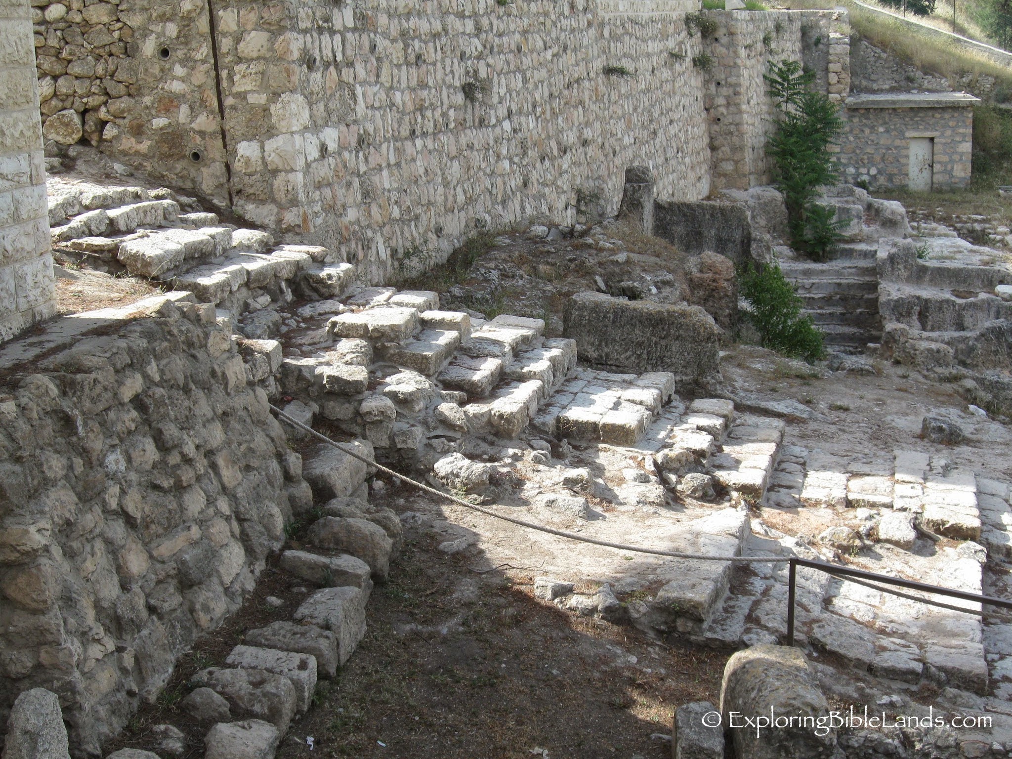
 Maps are good things. But because maps are two-dimensional, they do a terrible job of helping the user understand the changes in terrain. The city of Jerusalem is actually very hilly, even more so in the First Century. Today's picture is of some First Century steps that led from the lower city to the upper city. It is very possible that Jesus went up and down these steps on the last couple of days before he was crucified.